
Alexandra Buga
Cultural Heritage & 3D Digitization Practitioner
Akrokeramo / Antefix
Digital 3D photogrammetric reconstruction of a traditional Greek akrokeramo (ακροκέραμο / antefix), measuring 12 cm in height. Decorative terracotta antefixes were historically installed along building eaves to seal the joins between roof tiles. They protected the underlying structure from weather damage while serving as a key ornamental architectural feature. This antefix features a classical palmette motif rising above volutes.
Technical Metadata
- Methodology: Close-range Photogrammetry
- Software: Agisoft Metashape
- Camera: Canon EOS 600D
- Focal Length: 55mm
- Aperture: f/8
- ISO: 100
- Shutter Speed: 1/4s
- Capture Date: June 30, 2026
AR Placement Tip
For best stability, hold your camera still and aim at a well-lit flat surface (like a floor or table).
Xiropotamos Costume Doll
A 3D photogrammetric model of a 43 cm tall doll wearing a handmade costume inspired by the Dodekaimero (Twelve Days) pagan ritual of Xiropotamos, Greece.
Technical Metadata
- Methodology: Studio Turntable Photogrammetry
- Capture Setup: 96 Photos (360° & Multi-angle)
- Camera: Hasselblad H3DII-39
- Lens & Settings: 80mm, f/16, ISO 50
- Processing: Agisoft Metashape
- Optimization: Blender (Topology & Geometry Fix)
- Challenges: Deep dark wool textures & fine bell/horn details required precise high-aperture studio lighting to prevent shadow clipping.
AR Placement Tip
For best stability, hold your camera still and aim at a well-lit flat surface (like a floor or table).
Old Windmill of Tolo
A 3D photogrammetric reconstruction of a historical windmill in Tolo, near Nafplio, Greece. Created as a digital twin for cultural heritage preservation, the model was generated using a DJI Air 2S drone. The capture strategy combined multi-altitude orbital flights at oblique angles to document the stone facades, followed by a nadir (top-down) grid pattern to capture the roof geometry and surrounding landscape.
Technical Metadata
- Methodology: Aerial Photogrammetry (UAV)
- Equipment: DJI Air 2S Drone
- Flight Strategy: Oblique Orbit & Nadir Grid
- Processing: Agisoft Metashape
- Purpose: Cultural Heritage & Documentation
- Location: Tolo, Nafplio, Greece
AR Placement Tip
For best stability, hold your camera still and aim at a well-lit flat surface (like a floor or table).
About the Route
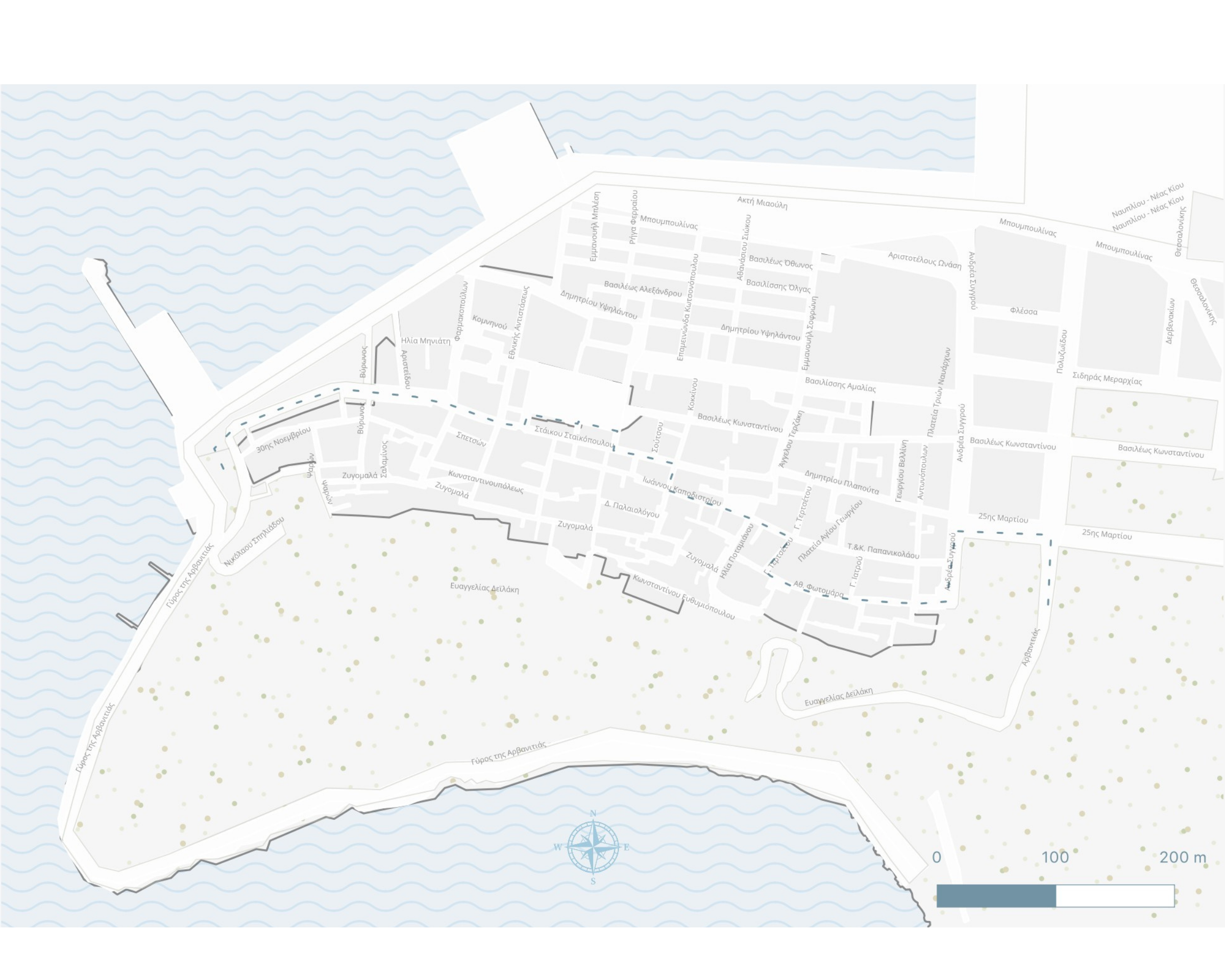
A map of a walking route showcasing a section of the historical fountain network constructed during the Second Ottoman Period, which supplied water to the old city of Nafplio. Created and styled using QGIS.
Ottoman Fountains Walking Route in Nafplio

About Me
I work in cultural heritage with a focus on documenting and preserving local history through 3D scanning and fieldwork. As the co-founder of Topikos Tropikos, my goal is to make local culture accessible through engaging digital tools and community initiatives.